Archivi:West Germany 1956-1990.svg

Grandezza de quetsa presualizzazion PNG per quell fail SVG chì: 450 × 456 picsel. Alter risoluzzion: 237 × 240 picsel | 474 × 480 picsel | 758 × 768 picsel | 1 011 × 1 024 picsel | 2 021 × 2 048 picsel.
Fail orginal (archivi in formad SVG, grandezza nominal 450 × 456 picsel, grandezza de l'archivi: 471 KByte)
Somari


.svg)
.svg)
.svg)
.svg)
.svg)


.svg)
.svg)
.svg)


.png)
.png)


.svg)


.svg)

.svg)


.svg)
.svg)
.svg)
.svg)


.svg)
.png)


.svg)


.svg)
.svg)


.svg)


.svg)


.svg)
.svg)
.svg)
.svg)
.svg)
.svg)
.svg)
_cropped.svg)
.svg)
.svg)
.svg)
.svg)
.svg)
.svg)
.svg)
.svg)
.svg)
.svg)
.svg)
.svg)
.svg)
.svg)
.svg)
.svg)
.svg)
.svg)
.svg)
.svg)
.svg)
.svg)
.svg)
.svg)
.svg)
.svg)
.svg)
.svg)
.svg)
.svg)
.svg)
.svg)
.svg)
.svg)
.svg)
.svg)
.svg)
.svg)
.svg)
.svg)
.svg)
.svg)
.svg)
.svg)
.svg)
| Sta qua la xe na imagine ritocà, che vol dir che la xe stà modificà digitalmente rispeto a la so version original. Modifiche: {{{1}}}. L'original el se pol védar qua: Blank map of Europe 1956-1990.svg.
|
Licenza
Mi, titolar del dirit d'autor, deciari de publicala sota questa licenza chìː
Quell fail chì l'è concedud in licenza sota la licenza Creative Commons Attribution-Share Alike 3.0 Unported
- Te see liber:
- de spartì con di alter persone – de copià, mandà in gir e trasmeter el lavorà
- de organizzà de noeuv – de adatà el lavorà
- Sota 'sti condizzion chì:
- atribuzzion –
Te gh'hee de fornì i sgiust credit, un conligament a la licenza e insegnà semai che ghe sien stad portad di cambiament. Te podet fall in una quaisevoeur manera rasgionevol, ma minga d'ona manera che la sugerissa che l'autor approva ti o la toa utilizazzion.
- spartiss con di alter persone a l'istessa manera. – Se ti te mett insema messedand, te transformet, o te scrivet sgiò el material, te gh'hee de mandà in gir i tò contribuzzion sota la same or compatible licens come l'original.
Register original del caregament
This image is a derivative work of the following images:
- File:Blank_map_of_Europe_1956-1990.svg licensed with Cc-by-sa-3.0
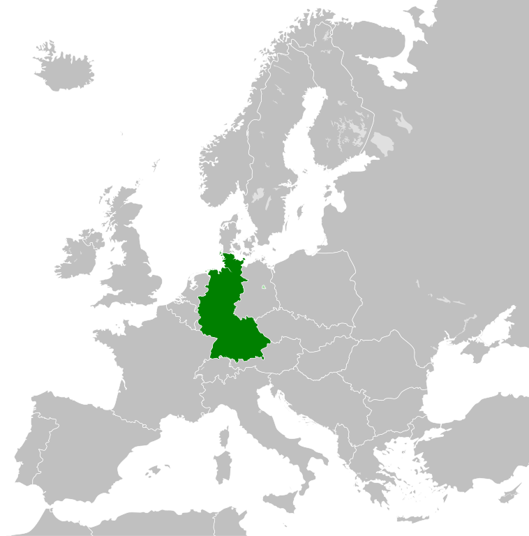
- 2011-10-30T04:43:42Z Alphathon 450x456 (485146 Bytes) == {{int:filedesc}} == {{Information |Description={{en|Blank map of Europe showing national borders as they stood from 1956-1990.}} |Source=*[[:File:Blank_map_of_Europe.svg|]] |Date=2011-10-30 04:42 (UTC) |Author=*[[:File:Bla
Cronologia de l'archivi
Schiscia in su un grup data/ora per vedè l'archivi com 'a l'è che l'era in quell moment là
| Data/Ora | Miniadura | Grandezza | Utent | Coment | |
|---|---|---|---|---|---|
| corent | 03:31, 28 set 2018 | | 450 × 456 (471 KByte) | FelipeRev | Se incluye Berlín Oeste pero con un color diferente, para marcar que pertenecía a su espacio económico |
| 06:04, 15 Lui 2015 |  | 450 × 456 (476 KByte) | Elevatorrailfan | Breaking apart West Germany and West Berlin paths. | |
| 03:43, 10 des 2014 |  | 450 × 456 (476 KByte) | Elevatorrailfan | West Berlin was not part of West Germany. | |
| 02:39, 26 nov 2011 |  | 450 × 456 (474 KByte) | StalwartUK | == {{int:filedesc}} == {{Information |Description={{en|Map of West Germany (Federal Republic of Germany) as it was from 1949-1990. Surrounding countries accurate from 1956-1990.}} |Source=*[[:File:Blank_map_of_Europe_1956-1990.svg|Bla |
Ligámm
Quell fail chì l'è doprad de la pagina chichinscì:
Utilizazzion global di fail
Anca questi Wiki chì a dopren quell fail chì:
- Doperad in af.wikipedia.org
- Doperad in an.wikipedia.org
- Doperad in ar.wikipedia.org
- Doperad in ast.wikipedia.org
- Doperad in be.wikipedia.org
- Doperad in bn.wikipedia.org
- Doperad in bs.wikipedia.org
- Doperad in ca.wikipedia.org
- Doperad in cs.wikipedia.org
- Doperad in da.wikipedia.org
- Doperad in el.wikipedia.org
- Doperad in en.wikipedia.org
- Doperad in eo.wikipedia.org
- Doperad in es.wikipedia.org
- Doperad in eu.wikipedia.org
- Doperad in fi.wikipedia.org
- Doperad in fr.wikipedia.org
- Doperad in fr.wiktionary.org
- Doperad in ga.wikipedia.org
- Doperad in gl.wikipedia.org
- Doperad in gv.wikipedia.org
- Doperad in ha.wikipedia.org
- Doperad in he.wikipedia.org
- Doperad in hi.wikipedia.org
- Doperad in hr.wikipedia.org
- Doperad in ia.wikipedia.org
- Doperad in id.wikipedia.org
- Doperad in io.wikipedia.org
- Doperad in it.wikipedia.org
- Doperad in ja.wikipedia.org
- Doperad in ka.wikipedia.org
- Doperad in ko.wikipedia.org
- Doperad in ku.wikipedia.org
- Doperad in lij.wikipedia.org
- Doperad in lld.wikipedia.org
- Doperad in lt.wikipedia.org
- Doperad in lv.wikipedia.org
- Doperad in mk.wikipedia.org
- Doperad in ml.wikipedia.org
- Doperad in mr.wikipedia.org
- Doperad in ms.wikipedia.org
- Doperad in nl.wikipedia.org
Varda utilizazzion global de quell fail chì.